AgriDrone Services are proud to offer drone crop surveying and crop health scanning as part of our range of agricultural drone services. We utilise the latest multispectral drone technology with advanced cameras to gather valuable information about crop and soil health. This biomass imagery enables farmers and agronomists to make informed decisions and optimise their crops accordingly.
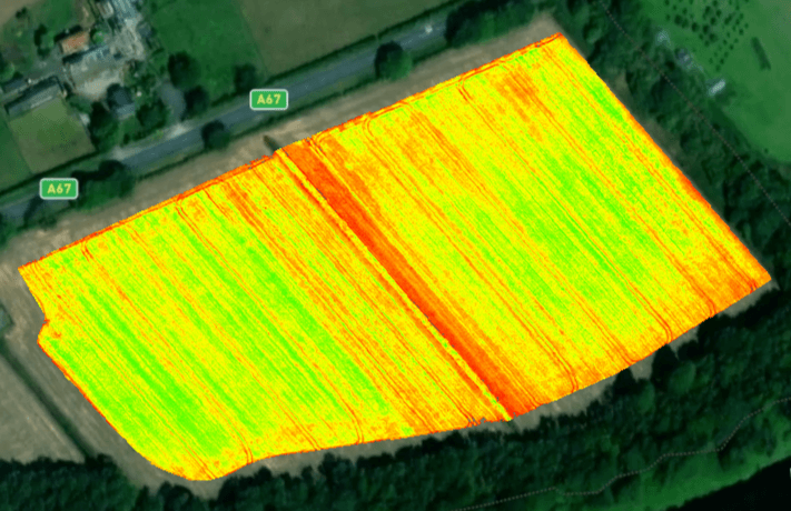
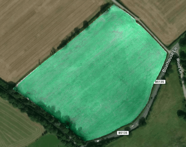
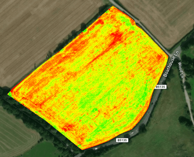
Our innovative approach allows us to capture high-resolution biomass imagery of farmland, which we then analyse to produce vegetation index maps. This data helps us pinpoint areas of poor growth and crop health, providing early detection of issues that may not be visible to the naked eye for up to two weeks. By identifying these problems in their early stages with a drone crop survey, farmers and agronomists can take timely action to mitigate potential losses and protect crop yield.
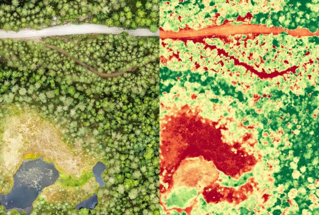
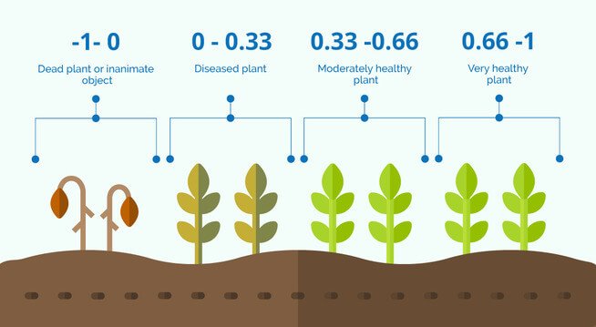
When creating vegetation index maps, there are a range of different indices available. The most popular and useful index is NDVI (Normalised Difference Vegetation Index) which quantifies the health and vigor of a crop by measuring how photosynthetic it is.
High NDVI values typically indicate healthy, green vegetation with high chlorophyll content, while low values may suggest stressed or sparse vegetation.
One of the key advantages of a drone crop survey is the ability to obtain more frequent and higher detailed biomass imagery compared to traditional satellites. While satellites offer a broader perspective, they are limited by their fixed orbits and can only capture low resolution images at specific intervals that break fields into 10m sections.
In contrast, our drones have a resolution of under 5cm and can be deployed on-demand, allowing for a more precise allocation of inputs and improved crop monitoring throughout the growing season. By utilising drone biomass imagery it enables us to detect changes in crop health in real-time and provide farmers with timely information that can guide their decision-making process.
Furthermore, our drones are not hindered by cloudy conditions, unlike satellites that rely on clear skies for optimal biomass imaging. This means that even when the weather is less favourable, we can still gather valuable data about crop health and identify potential issues. This flexibility is particularly beneficial for farmers in the UK with our unpredictable weather patterns and ensures access to accurate and up-to-date information in a broader range of conditions.
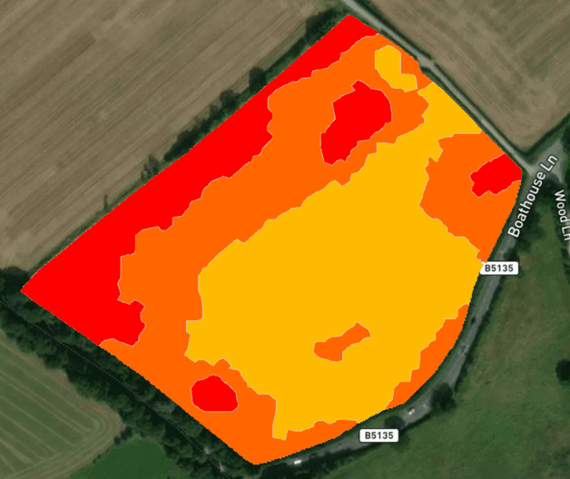
The biomass imagery generated from a drone crop survey can also be used to create prescription maps for variable rate application. By analysing the NDVI data and other relevant information, we can develop customised maps that guide the application of inputs such as fertilisers or pesticides. This precision approach allows for the optimisation of resource allocation, applying inputs to only where necessary. By doing so, farmers can reduce waste, minimise environmental impact, maximise crop yield whilst spending less and improve overall farming efficiency.
In conclusion, AgriDrone Services offers specialised drone crop surveying and crop health scanning solutions that enable farmers and agronomists to make informed decisions and optimise their farming practices. Our biomass imagery provides valuable insights into crop health, with more frequent and higher detailed imaging capabilities compared to satellites, as well as the ability to operate in cloudy conditions. We are proud to deliver accurate information for effective crop management that can be used to enhance resource efficiency and productivity. Please get in touch to find out more about how drone crop surveying can benefit your farm.