AgriDrone Services is a leading provider of aerial crop scouting services. With our expertise in utilising the latest drone technology and processing software, we are able to provide farmers and agronomists with a comprehensive overview of their crops that wouldn’t otherwise be available from crop walking alone.
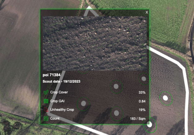
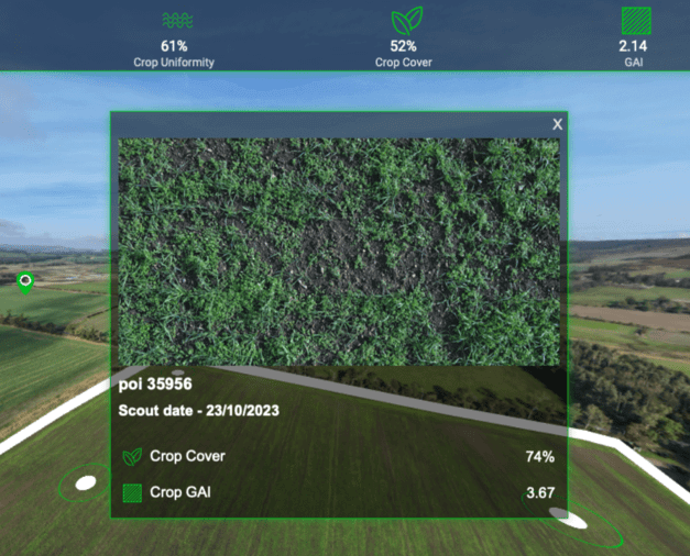
The use of advanced aerial crop scouting software allows our drones to capture images from both field level and leaf level, providing comprehensive reports on crop health. These reports offer valuable insights into the condition of the field and its contents, surpassing what could be achieved through traditional crop walking methods alone.
It should be pointed out that our drones do not eliminate the need for crop walking, but help to focus the time spent in field on the areas that need it.
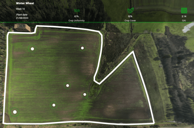
Using aerial crop scouting technology has revolutionised the way farmers and agronomists gather data about their fields. By utilising our drones equipped with advanced cameras, we are able to capture images from various angles and heights, providing a detailed overview of the entire field. This approach to crop scouting allows us to identify problem areas and potential issues that could be missed when crop walking. Using advanced software, we can analyse the data to highlight specific areas of concern, helping farmers and agronomists take proactive measures to address them.

One of the key advantages of aerial crop scouting is its ability to reduce the need for crop walking. Traditional methods involve physically traversing the field on foot, which can be time-consuming and labour-intensive. Additionally, walking through crops can potentially damage the plants and disrupt their growth. With aerial scouting, our drones can quickly navigate through fields, capturing images that cover a large area in a short amount of time. This allows us to gather data on crop health more efficiently and accurately.

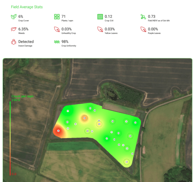
Skippy Scout plays a crucial role in our aerial crop scouting services. This powerful tool from DroneAg enables us to analyse the images captured by our drones, extracting valuable information at both field and leaf level. By leveraging advanced algorithms and artificial intelligence , Skippy can accurately identify and quantify various parameters such as crop health and weed cover. It can also generate detailed reports that provide farmers and agronomists with actionable insights into their crops, helping them make informed decisions about irrigation, fertilisation, pest control, and overall crop management. This allows for more precise and accurate recommendations to be made on inputs, reducing costs and improving yield.

AgriDrone Services is at the forefront of aerial crop scouting services. With the help of DroneAg’s Skippy Scout software, we are able to provide farmers and agronomists with detailed insights into their crop health and performance. Our aerial scouting services offer a more efficient and accurate approach to crop monitoring and management compared to traditional methods alone, providing valuable data for making informed decisions that maximise crop yields and profitability. Contact us today to find out more.
